Long-term erosion modelling using SIBERIA
- Post Date
- 05 May 2022
- Read Time
- 6 minutes
The growing concern for our environment continuously pushes industry to develop techniques to accomplish sustainable and stable engineering practices. Within mine closure design, soil erosion is one of the challenges that needs to be dealt with to ensure that the proposed rehabilitation solutions can withstand the passing of time. Currently, there are a few tools to model erosion, however there is one that has been used for more than 25 years and has become an industry standard.
What is soil erosion?
Soil erosion is the removal of soil particles from a surface by external forces e.g. wind and water, which are then transported and deposited in a different place.
What causes soil erosion?
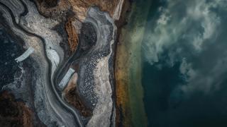
- There are several physical processes that produce erosion, however the most influential are rainfall and surface runoff which produce four main types of erosion: splash, sheet, rill and gully.
- Splash erosion occurs when drops of rainfall hit the soil and detaches particles from the surface. Sheet erosion results when the soil is sufficiently saturated to produce runoff, which then transports loosened soil particles to a lower elevation.
- Rill erosion occurs when the runoff is more concentrated over smaller areas that result in the formation of rills of limited depth.
- Gully erosion is the most severe manifestation of erosion and occurs during or immediately after large storms, where concentrated runoff water flows in narrow channels and removes significant volumes of soil to produce deep incisions in the surface.
Why is soil erosion important?
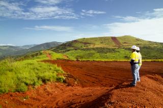
Since erosion results in soils loss, it is particularly important to control erosion to avoid the loss of capping soils and nutrient-rich topsoil from rehabilitated surfaces. For example, on mine sites or landfills the designer of a vegetated capping system aims to keep soil loss within rates that can be offset by the capping systems design. This assists in ensuring that the encapsulated material, such as potentially acid forming (PAF) waste in a mining environment or municipal waste, is not exposed after closure. The longer this protection is assured, the better it is for the surrounding people and environment. This is referred to as long-term stability.
Long-term stability is achieved by producing landform shapes and batter slopes that are less susceptible to erosion, controlling rainfall runoff, designing features such as bunds or armoured channels to resist soil detachment, and choosing the most appropriate vegetation for the particular area and climate.
How can soil erosion be measured?
There are a number of different methods available to estimate soil erosion. These include the Revised Universal Soil Loss Equation (RUSLE) which is an empirical method that predicts sheet erosion, and numerical modelling software such as CAESAR and SIBERIA. Both programs consider sheet modelling and also the development of rills and gulleys. CAESAR is generally more focused on short term erosion development, while SIBERIA is useful for long term erosion and has been widely used in industry for more than 25 years.
SIBERIA solves the partial differential equations that quantify the transport of sediment through a landscape, and the erosion and deposition that result from that sediment transport. SIBERIA requires site-specific input data for how runoff relates to rainfall, drainage area and slope, and how sediment yield relates to runoff and slope.
SIBERIA is a model specifically designed for long-term simulations and has been thoroughly tested by the industry. Some benefits of SIBERIA include:
- Provides all the functionality of other erosion models but operates on a digital elevation model (DEM) grid.
- Both erosion and deposition can be calculated at each DEM grid cell and it adjusts the elevation time step by step.
- Determines the type of erosion, erosion rates and produces shape plots.
- Combined with GIS and CAD software the erosion and deposition can then be clearly presented in 2D and 3D.
How long can SIBERIA predict erosion?
SIBERIA can quantify estimates of long-term erosion rates with most assessments typically being done over 200 to 500 years. Longer periods can be utilised if additional parameterisation is utilised.
What is needed to develop an erosion assessment?
SIBERIA requires input of a Digital Elevation Model (DEM). The DEM can be obtained by LiDAR measurement of the existing site, alternatively, if the landform is part of the design, SIBERIA can serve as a validation and decision-making tool to inform the design. Soil parameterisation can be determined for site-specific soils via flume testing in the laboratory, however, it is also possible to perform a high-level check using parameters obtained from nearby sites. Understanding the agronomical behaviour of the site, and how vegetation will develop is also a key input in the modelling.
What are the outputs of an erosion assessment?
Typical outputs from an erosion assessment include:
- Elevation changes during the period of analysis;
- Predicted erosion rates;
- Average erosion depths across the site;
- The types of erosion expected; and
- Maximum gully depths and their expected location.
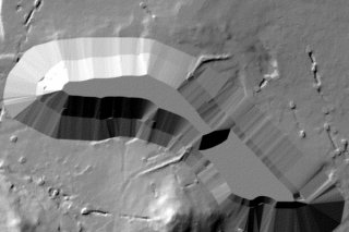
Results can be presented as 2D and 3D images. Figures 1 and 2 show a mine waste rock dump at closure and after 500 years. Of interest in Figure 2, not only does the model predict the designed landforms’ behaviour after 500 years, but also that of the natural surroundings, which can be useful in helping blend designed landforms into the surrounding areas.
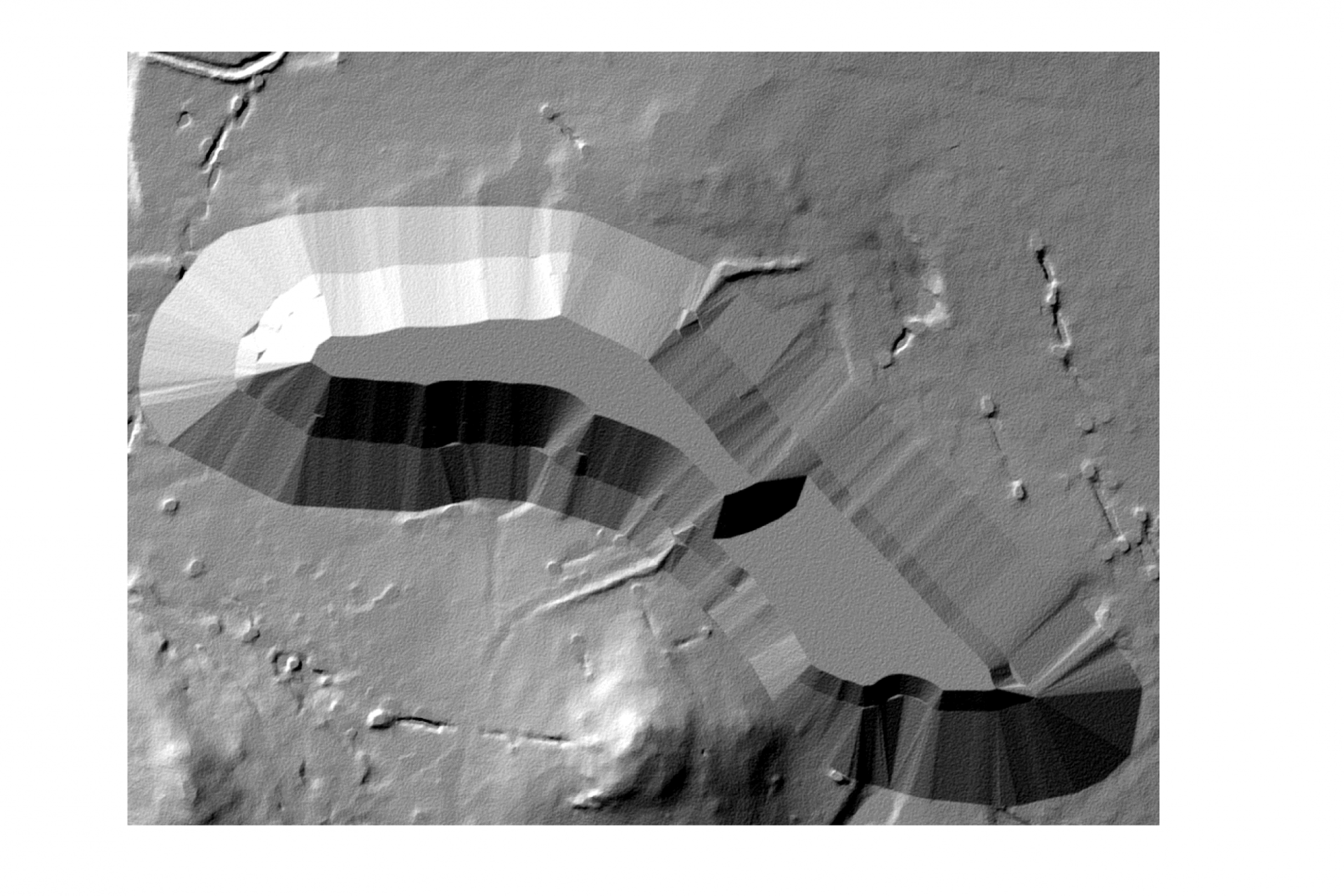
Figure 1 current conditions
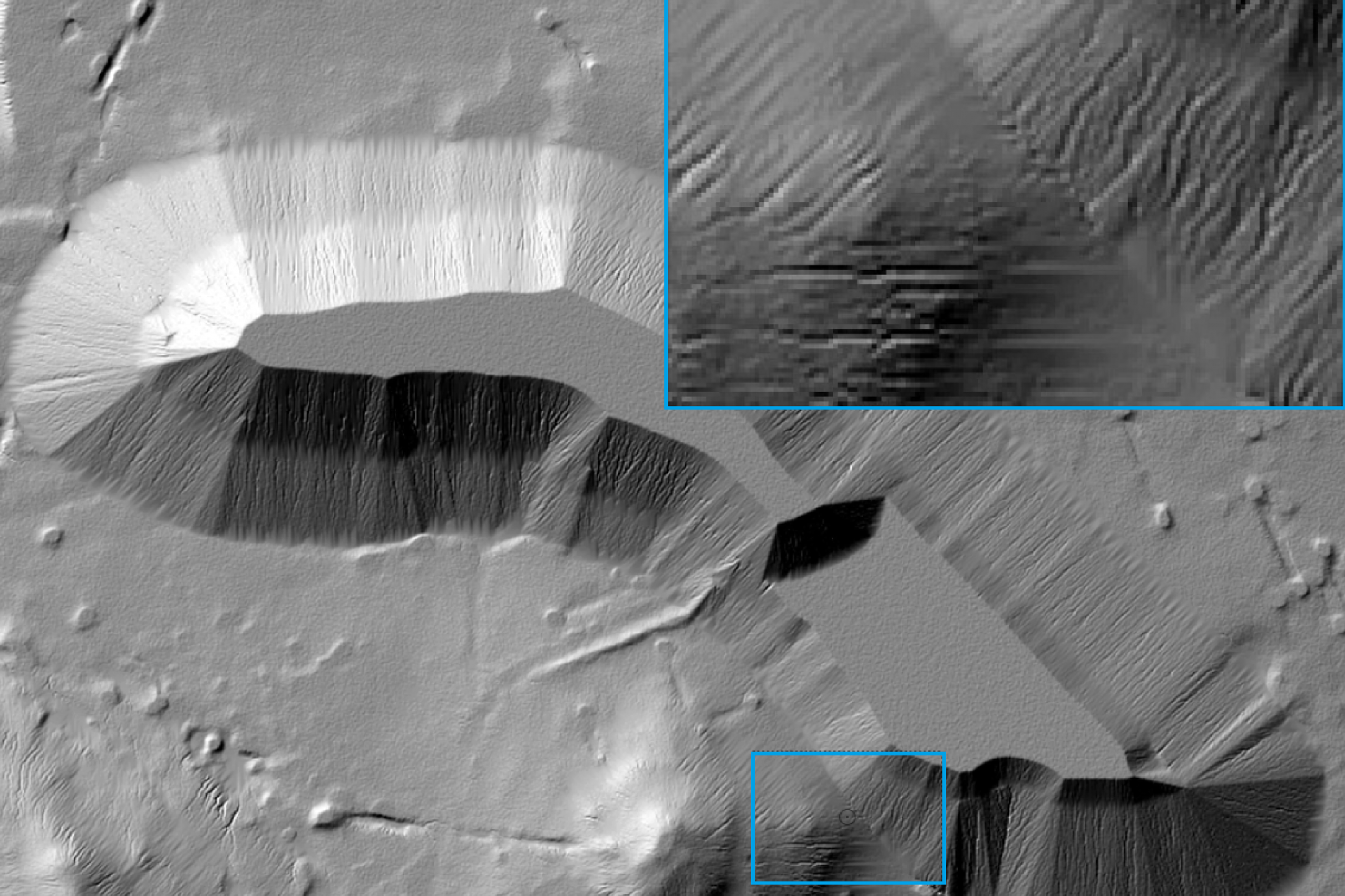
Figure 2 500 years after. Blue square shows comparison of natural (left) and manmade (right) features
Figures 3 and 4 show the 2D plots which highlight location and degree of erosion. This is particularly useful for informing areas where surface water protection measures would be most beneficial.
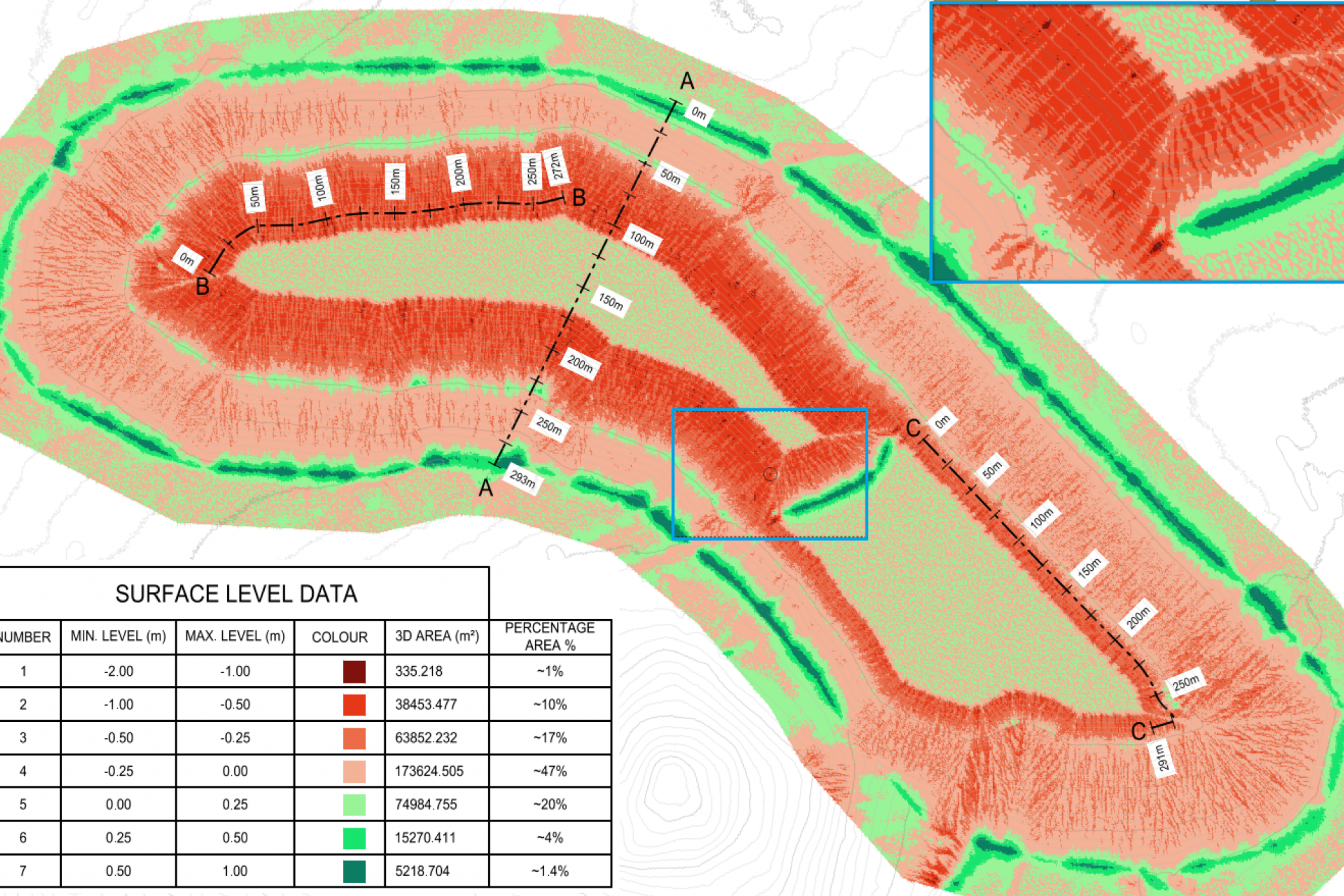
Figure 3 Colour map indicating erosion degree and location
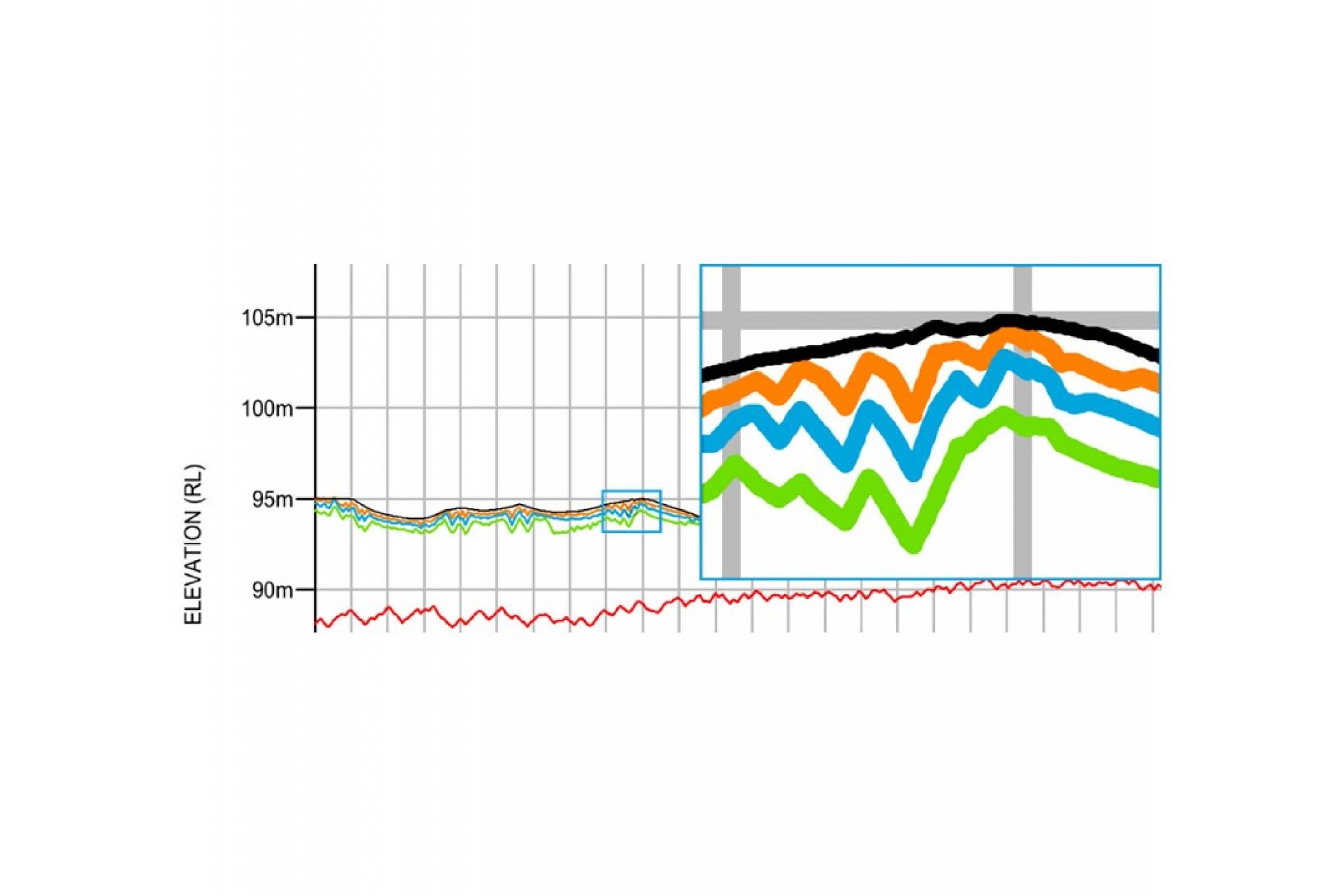
Figure 4 Black line shows the initial profile; orange, blue and green lines represent 200, 500 and 1000 years of erosion
What industries can benefit from this type of assessment?
Any soil or vegetated covered surface that is meant to remain long-term is susceptible to erosion and therefore would benefit from an erosion assessment. Assessments include both landforms and structures under design and existing sites. SIBERIA is a very effective tool to inform decision making when any type of slope cover or rehabilitation systems are being considered.
Article written by:
Augusto Riascos
Senior Project Consultant – Geotechnics and Mine Waste Engineering
Asia Pacific
Recent posts
-
-

Making sense of “Energy-as-a-Service” contracting options to balance risks and value
by Vincenzo Giordano, Philippe de Schoutheete
View post -