Rehabilitation Plan Visualisation Tool
- Client Name
- Whitehaven Coal
- Location
- Various Locations, Australia
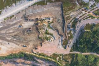
Challenge
Detailed closure planning studies undertaken as part of the CCL701 detailed mine closure planning process identified multiple areas requiring rehabilitation activities as part of closure execution.
Being a legacy site, areas were spatially distributed across the site with numerous issues identified and a variety of rehabilitation strategies required.
Whitehaven required a solution such that all recommendations and strategies were appropriately identified and mapped.
Solution
SLR provided linkage of spatial GIS data to environmental issue, rehabilitation strategies, materials balance/requirements, and bill
of quantities.
The process included:
- Spatial identification, ground truthing and delineation of areas of environmental concern in the field via iPad/GPS.
- Classifying polygons/points by feature and aspect (i.e. erosion, contamination, HAZMAT, and mine entries etc)
- Determining rehabilitation and remediation requirements for each area based on detailed technical studies.
- Consolidating and incorporating rehabilitation strategies into excel with ID linkage to GIS polygons.
- Determination of rehabilitation material requirements to execute strategies and linkage to line items in Bill of Quantities for financial provisioning purposes.
- Development of webviewer/app-based solution to view areas and strategies on the ground via mobile phone/iPad.