GIS & Information Services
SLR uses Geographic Information Systems (GIS) applications to provide mapping, web applications, mobile mapping and remote sensing to analyse, collect, store, and display data to visualise complex problems. GIS is the foundation for mapping and analysing patterns, relationships in a geographic context.
GIS can be used in every project to perform analysis, display spatial and non spatial data, create collaborations and share vital information across the project team. GIS enables insight into complex problems, which in turn gives the end user something that is visually easy and meaningful to understand.

Overview
GIS provides a foundation for mapping, analysing patterns and relationships in a geographic context and transforms data into high quality visual representations. This enables our clients to make informed decisions and visually communicate concepts to regulators, professionals, and laymen alike.
Get in touch
Surveying & Spatial Science Overview
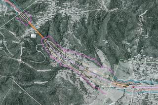
SLR offers comprehensive spatial and surveying services leveraging extensive experience across various industries for data management, analysis, image processing and analysis, topographical, bathymetric, and aerial imagery capture.
-
Surveying
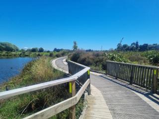
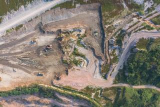
Our survey teams utilise cutting-edge technology such as terrestrial laser scanning, drone imagery capture, and remote-operated vehicle (ROV) bathymetric surveys. This combination allows us to deliver high precision and accurate data suitable for a wide range of applications, including quarry and mine design, engineering design, asset inspections, and environmental assessments. By owning and operating our aircraft, survey equipment, and processing software, we offer significant benefits in turnaround time, cost efficiency, and quality of information that seamlessly integrates into our client’s business plan.
Our surveying services extend to industries such as energy, waste management, planning and development, civil engineering, mining, quarrying and construction.
Coupling these data capture capabilities with our Spatial team enables a range of solutions that can be applied across many applications and projects for clients. This technology can be used to increase efficiencies, innovation and provide a key differentiator for our clients.
-
Spatial Science
GIS provides a foundation for mapping, analysing patterns and relationships in a geographic context and transforms data into high quality visual representations. Enabling our clients to make informed decisions and to visually communicate concepts to regulators, professionals, and laymen alike.
Our team uses GIS applications to provide mapping, web applications, mobile mapping and remote sensing to analyse, collect, store, and display data to visualise complex problems. GIS is the foundation for mapping and analysing patterns, relationships in a geographic context.
GIS can be used in every project to perform analysis, display spatial and non-spatial data, create collaborations and share vital information across the project team. It enables insight into complex problems, which in turn gives the end user something that is visually easy and meaningful to understand.
Services & Benefits
Our team leverages a diverse array of advanced technologies, to deliver cutting-edge solutions that drive significant value and tangible benefits for our clients, whilst ensuring the most effective and efficient outcomes are achieved.
Our services
- GIS project set-up including the development of specifications and management of spatial project plans
- Data capture, collation, and management to provide single source of truth for all data
- Drone surveying
- Bathymetric Surveying
- Terrestrial Laser Scanning
- Data conversion, digitalisation and georeferencing
- Geoprocessing and spatial analysis
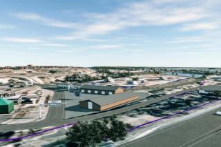
- 3D spatial modelling and visualisation
- Mobile data collection using customised applications
- Web map development and hosting
- Interactive digital presentation platform
- Dashboards for presentation of real time data
- Interactive digital presentation platform
The Benefits
- Improved communication of spatial data between disciplines -A visual component can make data easier to understand and provide single point of truth.
- GIS promotes collaboration amongst teams, stakeholders and clients - The sharing of data through interactive web maps and other GIS applications leads to seamless understanding of spatial data.
- Ability to visualise complex spatial data - GIS can create dynamic visualisations that provide insight into patterns, relationships and trends.
- Improved decision making - GIS can empower users to see up to date, accurate information, which leads to informed choices and effective planning.
- Improved efficiency to collect data using customised data entry forms or map-based applications - Reduce time and duplication of effort by automating workflows by developing processes to manipulate and modify data.
- Drone Surveying – capture high-resolution aerial survey data, allowing for safer, faster, accurate and more cost-effective mapping, even in remote or challenging terrains.
- Bathymetric Surveying – With state-of-the-art sonar and hydrographic equipment, we can deliver precise bathymetric survey and mapping.
- Terrestrial Laser Scanning – Utilising high-accuracy laser scanning, we can monitor structural movement and surface changes with millimetre precision.
GIS & Information Services Projects
-
-

-
-
-
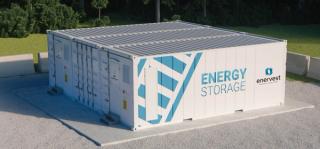
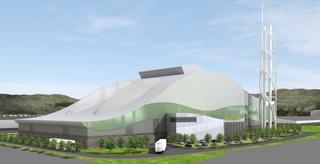
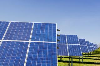
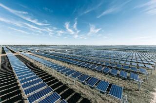
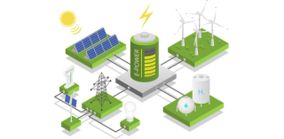
Lead environmental consultant for a large scale grid connected battery development portfolio
Read more -

-
-
-
-
-

-
-
-

-

-

-
-

-

-

Our Team Includes
-

Peter McGown
Technical Director, GIS and Information Services – Asia Pacific
-

Nathan Turner
Principal Consultant, GIS & Information Services – Asia Pacific
-

Ashleigh Pritchard
Associate Consultant, GIS & Information Services – Asia Pacific
-

Matthew Kirk
Geotechnical Engineer & Chief Remote Pilot, Groundwork, Part of SLR – Asia Pacific
-

Laena French
Senior Project Consultant, GIS & Information Services – Asia Pacific
-

Jeeju Hudson
Project Consultant, GIS & Information Services – Asia Pacific
-

Tristan Throup
Groundwork, Part of SLR – Asia Pacific, Groundwork, Part of SLR – Asia Pacific
Get in Touch
We're here to support you in Making Sustainability Happen. Get in touch for a collaborative discussion about what that could look like for your organisation.
Our locationsFill in the below form and we'll get you to the right place.