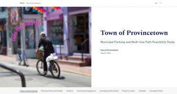

Connecting a Singular Community: A Multi-Use Path for the People of Provincetown
- Client Name
- Town of Provincetown, MA
- Location
- Provincetown, Massachusetts, USA

This project received the 2025 Merit Award from the Connecticut Chapter of the American Society of Landscape Architects (ASLA).
Challenge
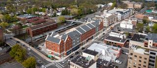
Provincetown, MA is a vibrant and thriving community that sits on a peninsula extending into the Atlantic Ocean. One of the area’s most important features is the natural balance between the active and vibrant community that lives within Provincetown and the naturally occurring landscape, which includes rolling sandplains and dunes, Atlantic white cedar swamps, and wildlife preserves. Provincetown is home to galleries, shops, and restaurants, but the downtown core lacks municipal parking areas and connecting bicycle/pedestrian infrastructure, which impedes visitor access and creates vehicular congestion during summer months.
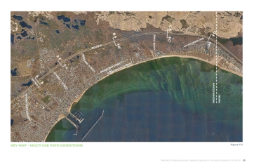
Bicycling and walking are much-loved pastimes in Provincetown and are a viable transportation mode for residents and visitors. To continue to create safer, more connected transportation networks, this project examined the feasibility of creating a new multi-use path along the Route 6 highway. The multi-use path would realize the community’s vision of a bicycle network on the Outer Cape, linking downtown Provincetown to Herring Cove Beach, the Cape Cod National Seashore, the Cape Cod Rail Trail, and towns to the south.
Additionally, the town is facing anticipated shifts in parking and transportation, including impacts associated with construction of the proposed NOAA Stellwagen Bank Sanctuary Visitors Center at the MacMillan Pier, which is expected to displace approximately 60 public parking spaces — spaces that are critical for visitors seeking to access the cultural and retail amenities within the Town Center. To plan for these impacts, this project examined the feasibility of relocating parking outside of the Town Center, to Route 6, between Shank Painter Road and Conwell Street.
When fully implemented, these transportation improvements will advance the Town goals for expanded mobility options and support Provincetown’s important partnership with NOAA and the National Park Service.
Proposed changes to the local transportation network must align with the community’s needs and preferences. As such, Existing Conditions Analyses, Conceptual Alternatives and a Preferred Option for parking and a fully separated multi-use path have been developed for the project, all with significant input from the community.
Solution
SLR set to work on this project by first thoroughly compiling physical and environmental data from ArcGIS, regional transportation studies, MassDEP, and the US Department of Fish and Wildlife. Supplemented with in-person field investigations, the team sought to identify potential opportunities and constraints associated with adding parking and a multi-use path.
The design team analyzed past studies that had previously explored the feasibility of adding bike lanes along the Route 6 Highway (the primary highway that runs the length of peninsula.) Armed with information and previous proposed concepts, the design team set to work to develop three optimal-use path alternatives and multiple options for parking along Route 6.
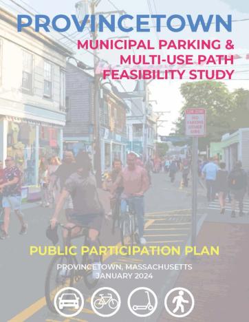
Public Participation Plan
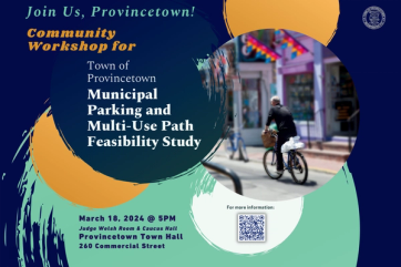
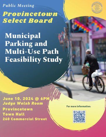
As the project prioritized community support and transparency, the SLR team developed a Public Participation Plan, creating a road map for community outreach. To engage with a wide spectrum of stakeholders, the team developed an interactive website, enabling the public to engage in a survey, learn about meetings, and keep up with the project’s progress in real time.
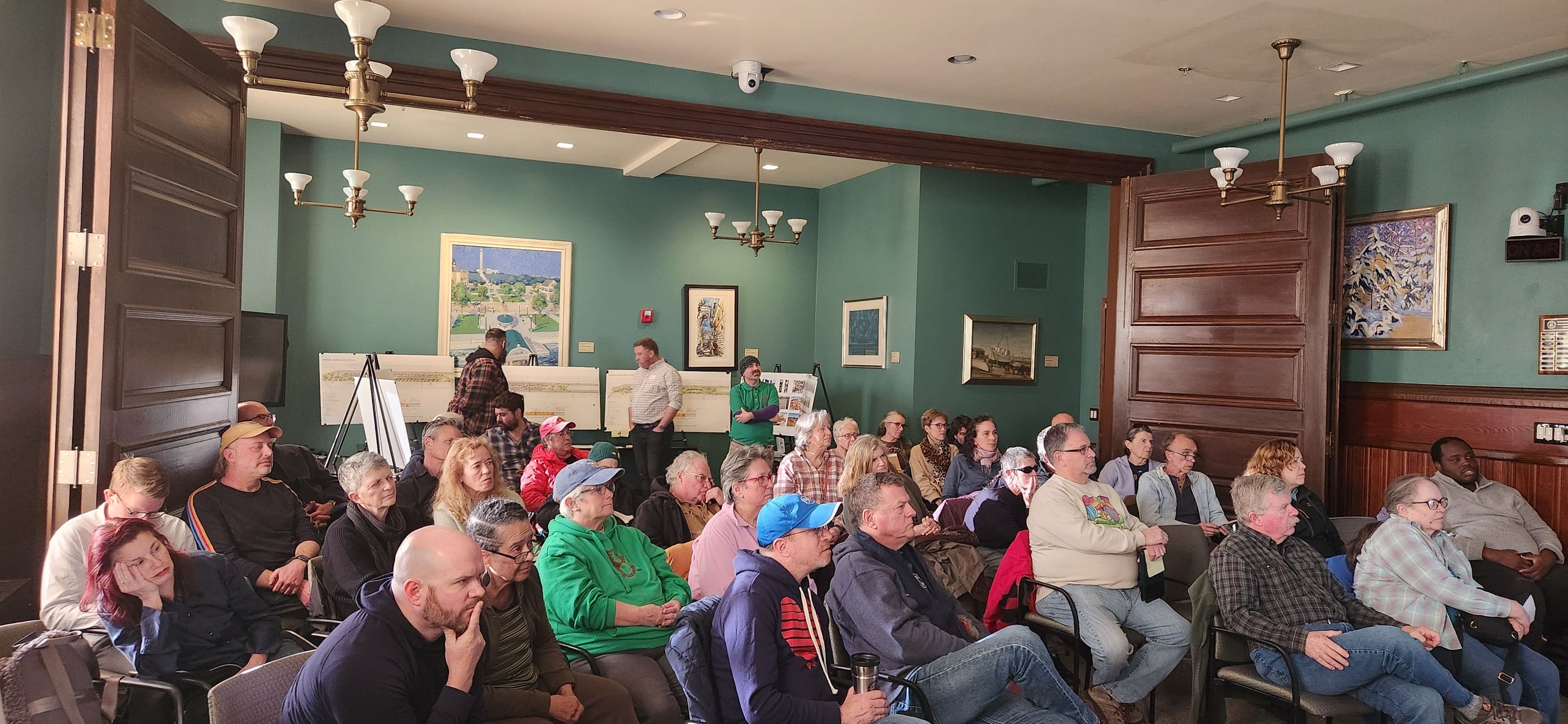
SLR supported two community workshops which highlighted existing conditions and trends affecting parking and bicycle/pedestrian access on Route 6. The workshops, used as a springboard for community collaboration and discussion, identified community concerns, potential strategies, and implementation steps. Attendees used stickers, placed on boards, to identify preferences and provided valuable comments which assisted the team in modifying the design alternatives to best reflect the needs of the community.
Design Selection
Driven by community feedback, design concepts for both the multi-use path and Route 6 parking were selected and proposed to the Town.
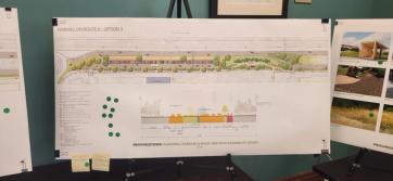
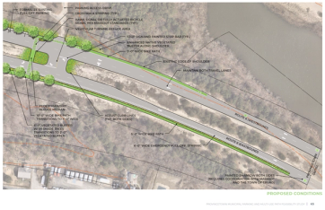
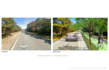
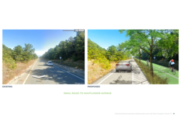
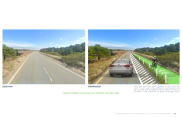
Out of the three concepts developed for the multi-use path, the option selected proposed eliminating one eastbound (south side) lane to be converted into separate, dedicated travel ways for bicyclists and walkers, a shaded vegetated buffer between vehicles and pedestrians, and a six-foot wide pull off shoulder for emergency vehicles to pass. The design team developed sections and three-dimensional perspectives that illustrated to the township the specific changes to the roadway profile based upon physical constraints and areas of sensitive ecological characteristics.
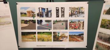
Three concepts were provided for the Route 6 parking area. The selected plan identified that the Town would benefit from a reduction of lanes along Route 6 to provide up to 164 parking spaces for community use. This design included a 24’ permeable paving access lane, a 13’ vegetated median- which includes native planting and stormwater quality basins, and multi-modal pavilions for shuttles to the downtown, bike share, drinking fountains and charging facilities.
Impact
Once the preferred alternatives for the multi-use path and parking were complete, the team provided the community-supported proposal to the governing body of Provincetown. The team then developed preliminary construction costs to assist the Town with state/federal funding opportunities and provide an online of next steps for implementation including design phases and associated fees.