Newhills: Rowett South
- Client Name
- University of Aberdeen, Bon Accord Land Promotion Ltd.
- Location
- Aberdeen, Scotland

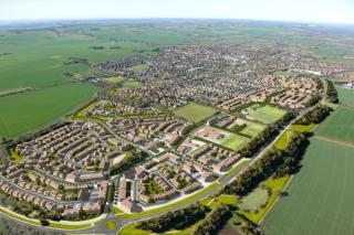
Rowett South is part of the Newhills Expansion Area, a major urban expansion area on the western edge of Aberdeen City. It is one of the most significant expansion areas for Aberdeen in the next 20 years. Strategically, the Newhills area will form a new western boundary to the city and benefits from excellent connections via the AWPR and the A96(T) both into the city and outward to the surrounding area.
SLR's Place team has been involved in appraising the potential of the overall Rowett land holdings since 2009 and was commissioned to produce a detailed masterplan specific to Rowett South following work on the overarching Newhills Development Framework. The masterplan picks up and progresses the key principles established by the Newhills Development Framework to show how a rich, connected green infrastructure network and strategic placement of mixed use areas within the development can create a substantial new settlement with associated infrastructure and facilities.
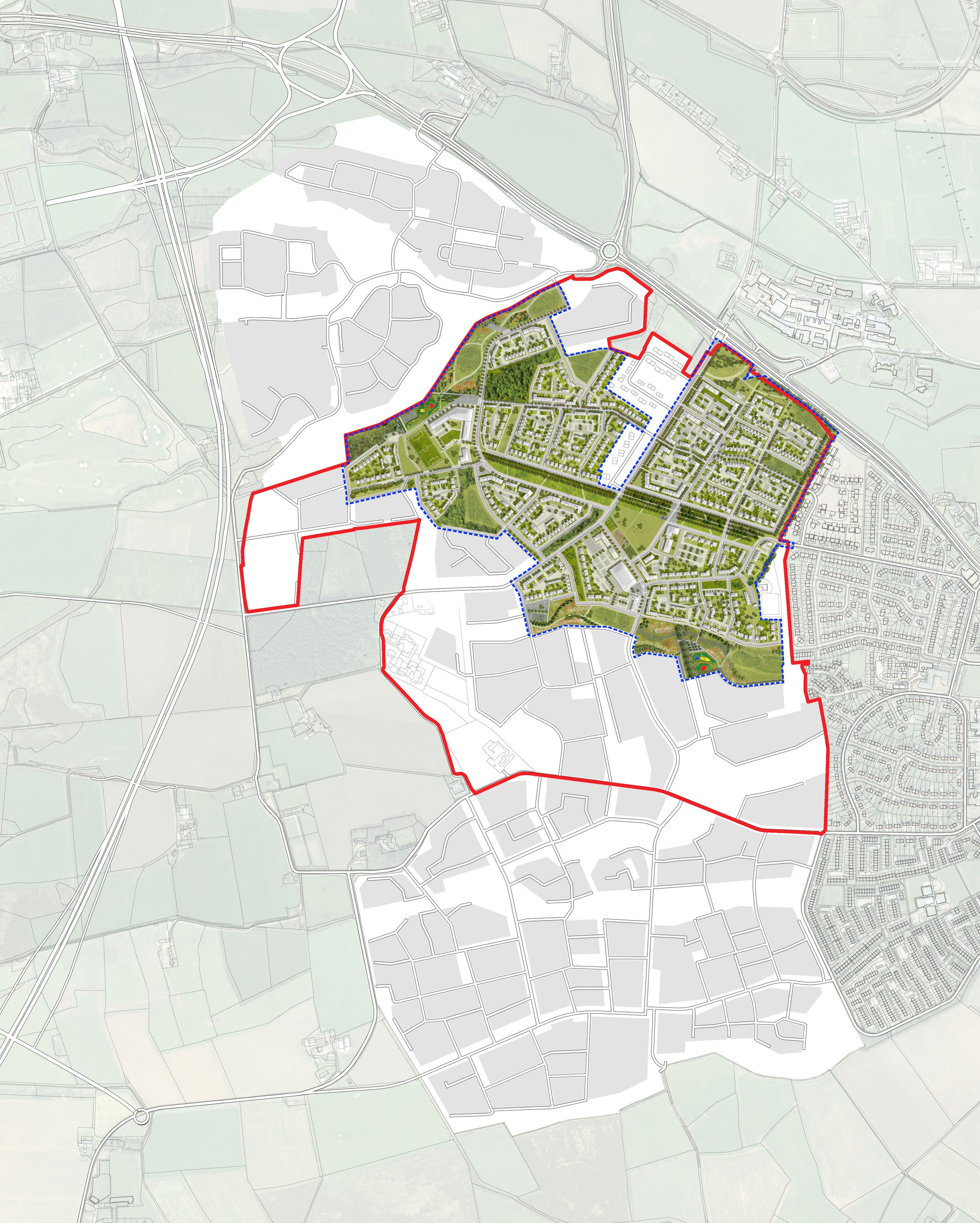
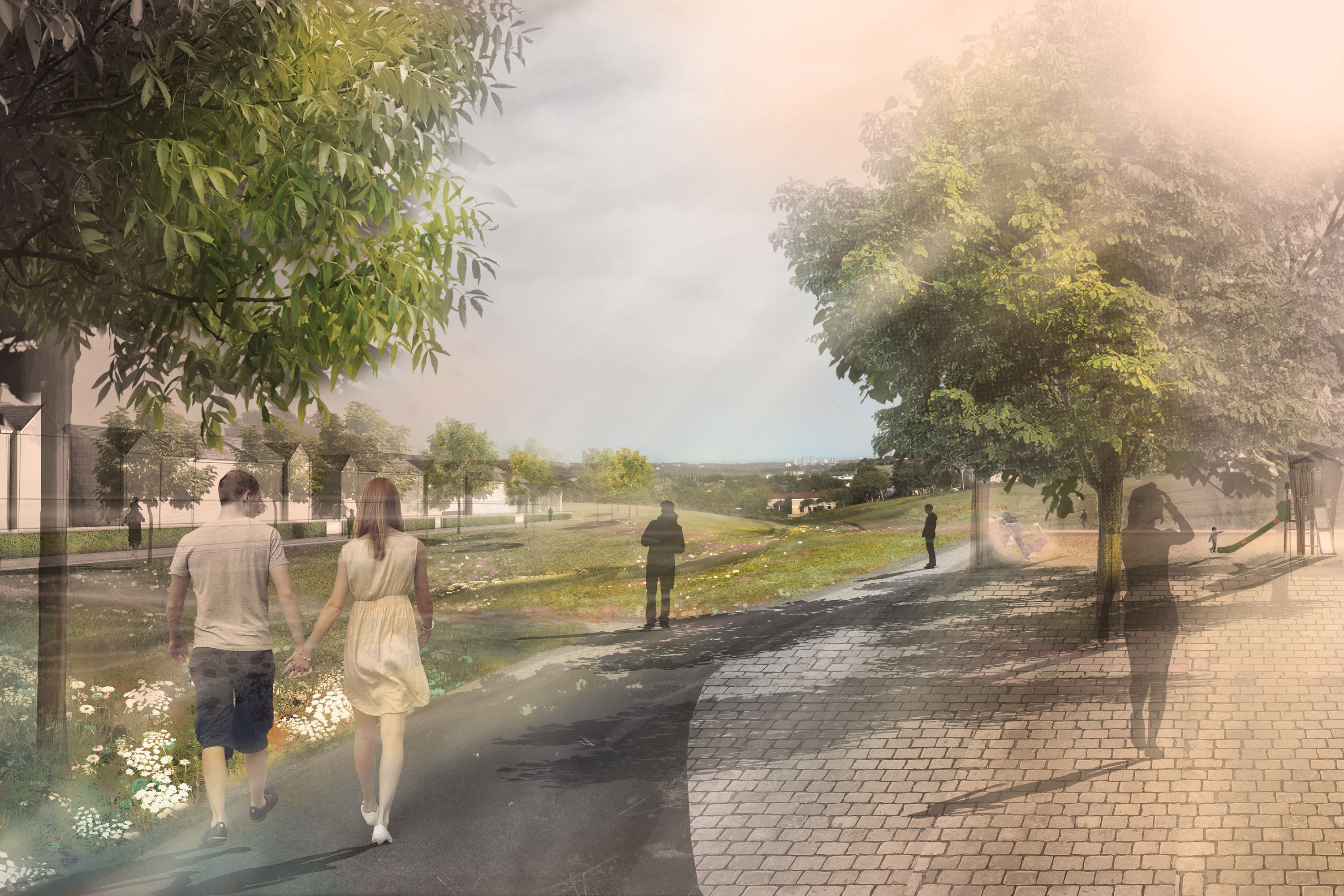
The design works with the rolling topography of the site, protecting and enhancing local ridges and valleys through the careful planning of open space and residential development blocks. Open spaces are highly programmed to ensure that they can be used for a diverse range of passive and active recreational uses as well as providing viable green corridors for existing protected species such as badger and red squirrel, which are found in the wider area.
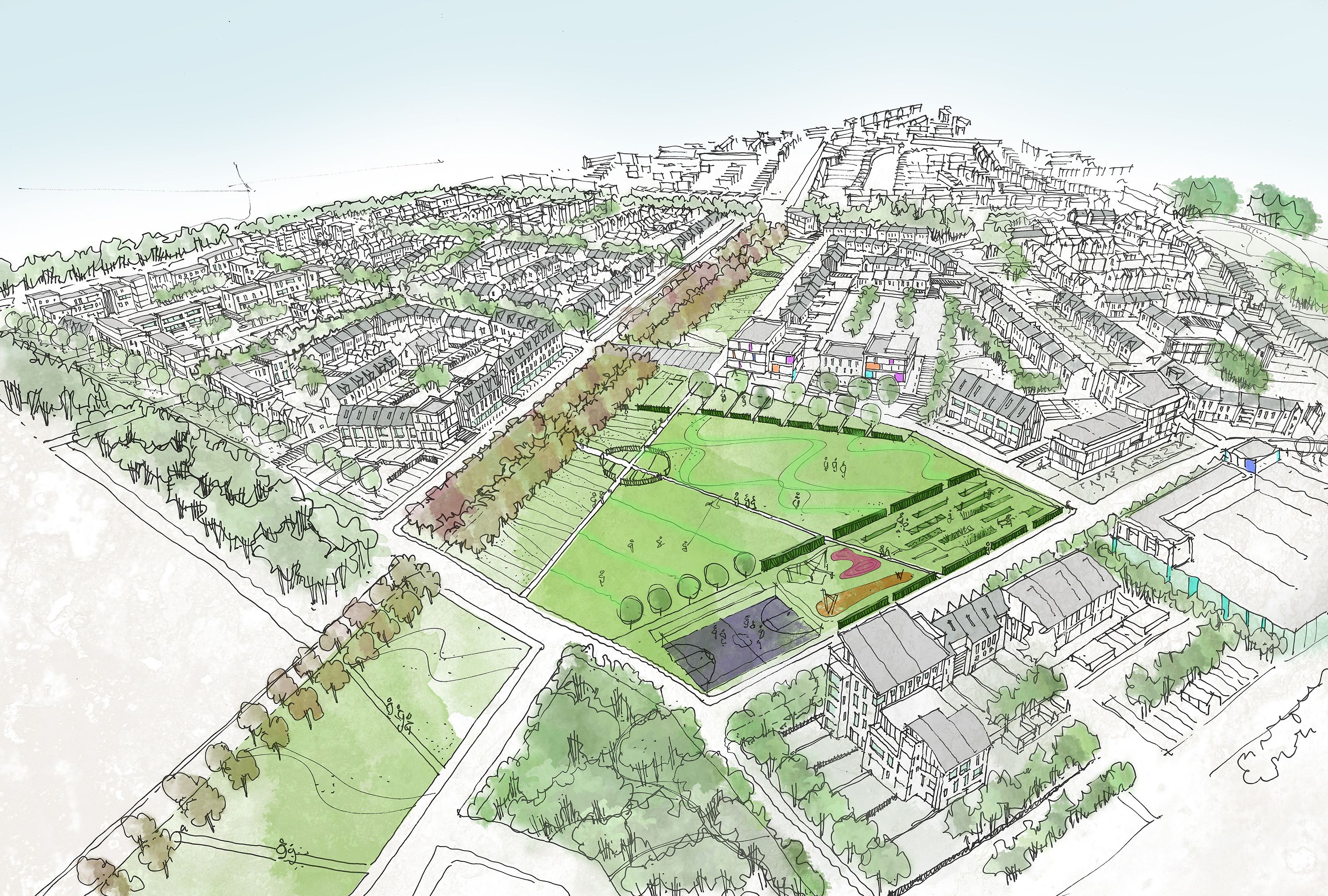
In an innovative approach to the provision of outdoor sports, rather than force large-scale playing surfaces onto the existing sloping topography which would have resulted in significant and unsympathetic earth-modelling, a network of cross-country trails for running, biking or horse-riding has been integrated into the masterplan. These largely traffic-free circuits are readily accommodated within the proposed network of green spaces and corridors and offer a positive and attractive feature for new residents in the settlement.
OS Mapping © Crown copyright, Aberdeen City Council 100023401 (2012). Aerial imagery © Google 2012

