
Detailed site masterplan for Dreghorn
- Client Name
- Miller Homes / Taylor Wimpey
- Location
- Edinburgh, Scotland
Challenge
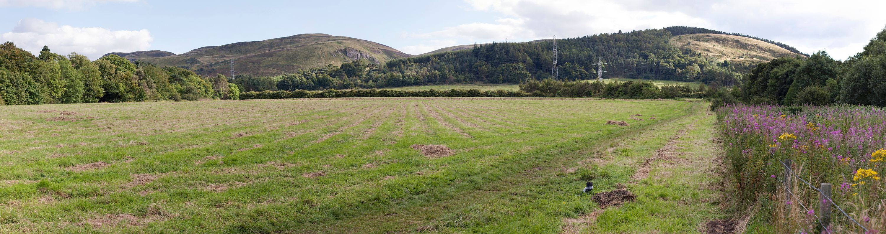
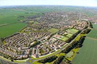
The site at Dreghorn was formerly part of the Army’s Polofields prior to the construction of the bypass forty years ago and has remained unused since then, however its use by the local community meant that its redevelopment was highly contentious. The site has panoramic views out to the Pentland Hills, and has always been considered to be sensitive to the impacts of new development. SLR's Place team were first appointed to carry out site assessment that would determine landscape capacity, the integrity of its contribution toward the Edinburgh Greenbelt and the opportunities for sensitive development.
Following the consent of Planning Permission in Principle, SLR was commissioned to work up the detailed site masterplan along with Miller Housing. Because of the site’s sensitivity, a protracted and detailed round of pre and post application discussions with both the City of Edinburgh Council and the community ensued. As part of this, it was important to understand the exact implications of new development upon the landscape, the views at key points of entry and on the mature woodland along the edge of the site.
Solution
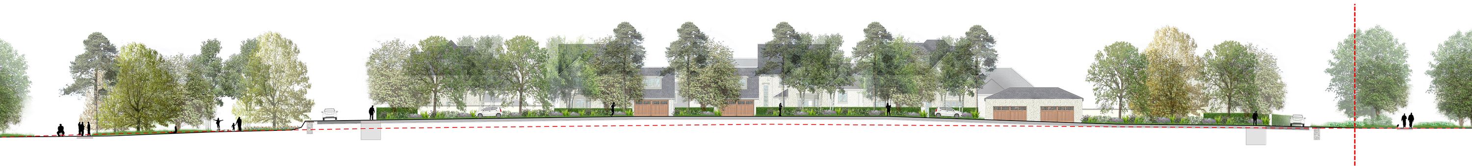
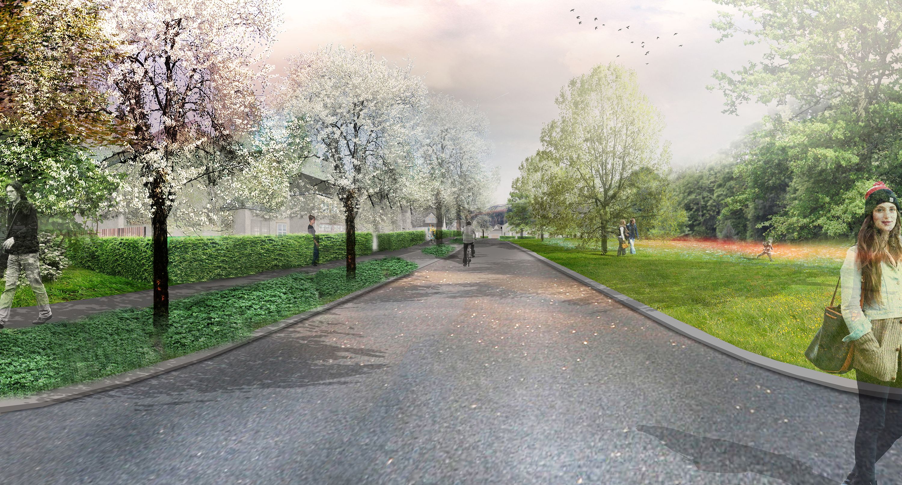
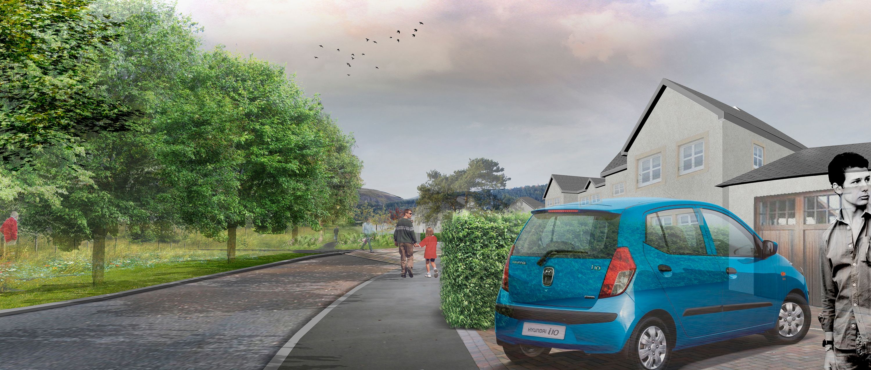
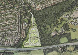
To enable discussion and decision-making a number of viewpoints were identified and agreed for the production of photo-montages which would be prepared to an accurate degree. A landform model was produced using the proposed landform contour data integrated with the existing site topographical survey and for the wider extents of landscape extending to the Pentland Hills and beyond, Ordnance Survey Landform profile digital terrain model data was used. Photographs were taken at key viewpoints on the site and using GPS readings these views were replicated in the 3D model. Renders of the proposed buildings and associated planting and public realm areas were generated and used as a base for the final images.
Impact
The accuracy behind the final images was a crucial part of the process and was significant in both persuading the community that the scheme could be well-integrated into its environment and in assuring the Council of the merits of the scheme. Montages were re-run with different options and trust between all parties was established through this process. As evidence of the success of the process, the City of Edinburgh Council has requested that imagery from the application submissions be used in its Best Practice Guide.