Orewa Estuary Management Plan
- Client Name
- Auckland Council
- Location
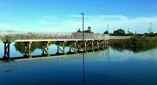
- Orewa, New Zealand
- Community planning
- Ecology
- Planning
Challenge
Auckland Council engaged the Planning, Ecology and Coastal teams to develop an easy-to-understand community-based restoration plan for the Orewa Estuary - Te Ara Tahuna.
The plan needed to provide a strategic approach and guidance to facilitate and encourage a community-driven restoration of the 12km coastal margin surrounding the estuary between the bridges of State Highway 1 and the Hibiscus Coast Highway. More specifically, it needed to provide and incorporate detailed information, advice, and tools on:
- Mātauranga Māori - including Māori history of the area and protocols for any accidental discoveries;
- Animal pest control – including the methodologies for undertaking pest control and associated monitoring;
- Environmental weed control - including the process for controlling weeds (supplemented by a reference guide);
- Restoration planting – identifying areas available for replanting, including a maintenance timeline, kauri dieback and myrtle rust information, eco-sourcing guidance and how to propagate rushes;
- Bird monitoring – including monitoring methodologies (supplemented by a reference guide); and
- Mangroves and sediment – including information on mangrove management and sediment monitoring.
The plan would also play an important role in the wider restoration projects along the Hibiscus Coast by building on the Forest and Bird Pest Free Peninsula initiative at Whangaparaoa, and the overall North-West Wildlink, by creating more safe, connected and healthy habitats for native wildlife across Auckland.
Solution
To inform on the development of the plan, the team needed to gain a detailed understanding of the current ecological and social context of the area by:
- Recognising from the outset that the plan was intended for use by the community, so the first step was to meet with various local groups with an interest in the estuary;
- Listening to the community groups to understand what is most important to local residents and what aspirations they have for the estuary;
- Undertaking thorough research of existing plans and information;
- Using Geographical Information Systems (GIS) technology to undertake detailed field surveys and inform visual plan development;
- Liaising one-on-one with a wide variety of Auckland Council departments, local mana whenua representatives, community and interest groups, Forest and Bird, and long-standing residents.
Following this approach, we developed a comprehensive Restoration Plan, with informative maps augmented by implementation and monitoring guidance.
The plan was designed for the community to pick up and understand what ecological restoration activities are needed around the Orewa Estuary and where. It then informed the community of the steps and methods to implement the plan.
Impact
From conception, the plan has been intended to develop lasting interactions between groups and provide an easy-to-understand and easy-to-implement means of enhancing the natural environment surrounding the Orewa Estuary. The plan delivered everything it set out to do and facilitated additional benefits only seen when community-based projects such as this are undertaken; for example, it enabled learning and sharing of knowledge, building a sense of community, and strengthening people’s connection to the area.
“We are really pleased with both the process used to create the plan and with the plan itself. The stakeholder engagement that was undertaken within Council, iwi, local groups and the surrounding communities’ and the willingness to accommodate the many different views expressed throughout the writing of this plan were highlights of this work for us. It has provided us with a great product that can be easily picked up and used by the community and by us too."
Chrissy Henley, Senior Biodiversity Advisor, Auckland Council